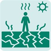
Risk assessment for heat stress
Rising temperatures and increasingly frequent heat stress events are presenting significant challenges for the Netherlands. These impacts are felt across three key domains: the environment, where outdoor spaces and ecosystems are affected; buildings, where elevated indoor temperatures can compromise comfort and safety; and public health, with heat posing serious risks to vulnerable groups. The clearly distinguishes and addresses these three domains to provide a comprehensive understanding of heat-related risks.
The environment
Environment or outdoor spaces are defined as all areas outside buildings, both public and private, such as gardens, parks, and forests, as well as paved areas like roads, shopping streets, and industrial areas. Outdoor heat issues are among others influenced by ambient, surface, and perceived temperatures, with cities retaining heat longer due to the urban heat island effect. High perceived temperatures, which varies by location and individual, can cause heat stress and is often measured using the physiological equivalent temperature (PET) value. For occupational settings, different comfort temperature thresholds are often applied, reflecting the specific physical demands and safety requirements of work environments.
The national datasets for PET values are available via the Climate Impact Atlas. These maps provide an initial impression of the local conditions. However, they may lack the necessary detail for addressing specific enquiries. These PET values are used to assess if the design of the urban space is sufficiently heat resilient. As the national PET datasets are based on a 35-year-old resting male, other indicators that better account for activity and specific conditions are more suitable for assessing working conditions or events.
An Urban Heat Island (UHI) effect map is available in the Climate Impact Atlas. It illustrates the average air temperature difference between urban areas and their surrounding rural environments. This effect is most pronounced at night when urban temperatures remain elevated. Due to the higher nighttime temperatures, the cooling of residences becomes less effective, which can negatively impact vulnerable populations such as infants, children, and the elderly.
In addition to extreme daytime temperatures, high nighttime temperatures can also cause significant discomfort and health issues. The Heat Stress Caused by Warm Nights map, also found in the Climate Impact Atlas. It shows the number of tropical nights in urban areas under the current climate and the 2050 high emission scenario, considering the urban heat effect. These warm nights pose health risks.
The Distance to Cooling map in the Climate Impact Atlas also helps identify areas with sufficient or insufficient access to cool spaces. For each home, the distance to the nearest cool space is calculated. These designated cool spaces meet the following basic criteria:
- Size: A public outdoor area of at least 200 m².
- Temperature: The perceived temperature on a very hot day should not exceed 35 °C, which typically means the area is shaded.
- Proximity to roads: A minimum distance from roads is required, with greater distances for roads with higher speed limits.
- Shape: Long, narrow spaces are excluded.
According to the Heat-Resistant Cities research report (PDF), and the guidelines Climate Adaptive Green Built Environment Benchmark, every home should have access to a pleasant and inviting cool space within a 300-metre walking distance.
Another important map that offers an indication of local conditions is the Shaded footpaths and cycle tracks map. This map displays the average percentage of shade along footpaths and cycling tracks by neighbourhood, as well as for individual paths and tracks. It also distinguishes whether the shade is primarily provided by trees or by buildings. Local authorities aim to ensure that at least 40% of walking and cycling paths are shaded.
Buildings
Many homes in the Netherlands were originally designed to maximise sunlight exposure. However, in an effort to reduce energy use for heating, houses have been insulated and effectively turned into heat traps. As temperatures continue to rise, these sun-filled homes are becoming less desirable and, in many cases, problematic. During the summer months, they are prone to overheating. Since 2016, over half a million additional air conditioning units have been sold. As heat resilience has only recently become a focus within the housing sector, truly heat-proof homes remain rare in the Netherlands.
For existing buildings there are only a few datasets with indicators which can help identifying the risk of heat related to buildings. On the one hand, building can become hot if the surrounding area is warm, for example, as shown on maps of the urban heat island effect, nighttime temperatures, or the distance to cool spots. The availability of shade also plays an important role. For the overheating of houses specifically, shade and nighttime temperatures are the most critical factors.
One of the maps currently in development is the Shade on Buildings map. This map will illustrate the extent of shade cast on buildings, helping to assess and prioritise the risk of heat-related issues in existing homes. It will show how much shade each building receives, with greater façade shading correlating to a reduced risk of indoor overheating. The map is being produced using the methodology developed through the National Water and Climate Knowledge and Innovation Programme (NKWK).
At the moment, only national maps are available that indicate which houses or buildings are most at risk of overheating based on their surrounding environment. However, factors such as orientation, window size, building type, ventilation options, shading, and insulation also play an important role in determining the actual risk of overheating. These factors are not yet taken into account.
Several initiatives have already been set up to develop steps to prevent newly built and renovated houses from overheating:
- The temperature exceedance indicator TOjuli (PDF), provides insight into the risk of indoor overheating for different building orientations.
- The Climate Adaptation Standards Consultative Body (OSKA) is working to ensure that building design standards reflect the realities of warmer summers and the growing need for cooling solutions.
- To raise awareness and encourage action on the increasing demand for residential cooling, Klimaatverbond Nederland together with Amsterdam University of Applied Sciences and the W/E Consultants Foundation, has launched a dedicated platform. This initiative aims to support visualisation efforts and prioritise the issue on policy agendas.
Public health
The impacts of heat can affect everyone, though the severity varies depending on several factors, including social circumstances. These factors are explored in more detail in the map narrative Social Vulnerability to Heat. This resource also provides insight into the level of social vulnerability within a municipality. The maps show where vulnerability occurs more frequently than average and can help prioritise areas for action.
Groups particularly vulnerable to heat include older adults, individuals living in social isolation, homeless people, those with poor health, individuals taking regular medication, young children, and those living in poverty. Older adults are especially at risk, as they are more likely to experience a combination of these risk factors, making them more fragile and susceptible to heat-related issues.
The map layer Over-65s with Fragile Health in the map narrative Social Vulnerability to Heat highlights where older individuals with increased vulnerability reside. Similarly, people living in poverty face heightened risks due to limited financial means to protect themselves from the effects of extreme heat. The map Households Below or Around the Social Minimum, also in this narrative, provides insight into where these households are located.