Policies & regulations for coastal and fluvial floods
Following the Netherlands Environmental Assessment Agency, the Netherlands is recognised as one of the best-protected deltas in the world. This could be attributed to the strength of Dutch water governance, which benefits from a fully public and highly decentralised structure, a robust and solid financial foundation, and a strong focus on implementation. For a detailed overview of how the Netherlands protects itself against flooding, refer to Fundamentals of Flood Protection (PDF).
- The Delta Programme Commissioner ensures that the annual Delta Programme is drawn up.
- The Delta Programme sets out measures to ensure that national water policy is implemented. Every six years the Delta Programme reviews the main goals for flood protection, which then can be adapted.
- The Delta Fund provides funding for flood risk management. For the period 2024‐2037, an average annual budget of €1.5 billion per year is allocated. For the period 2024‐2050 this is in total €27.4 billion. The Delta Programme Commissioner stated (PDF) that €30.8 billion is needed, and that if the budgetary tension increases in the future the effectiveness of the Delta Programme could be affected.
How flood protection is organised in the Netherlands
Since protection from flooding is so important in the Netherlands, much of it is governed by legislation. This is primarily the Dutch Water Act (2009), which has been subsumed into the Environment and Planning Act in January 2024. The current legislation is designed to ensure that every inhabitant of the Netherlands who is protected by primary flood defences receives at least ‘base level of protection’. This is defined as the likelihood that a certain individual becomes a victim of flooding may be no greater than 1 in 100,000 years. Additionally, a lower probability of flooding can be appropriate if the impact of flooding would be deemed too high based on societal risk and a social cost-benefit analysis (SCBA).
When it comes to the safety standards, a distinction is made between the primary flood defences, the regional flood defences, and unprotected areas.
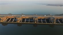
- The primary flood defences are the barriers that protect the land from major water bodies: the sea, the major rivers, the large lakes and sea inlets. These consist of levees, dunes, storm surge barriers, locks and dams. In total, 52% of the land surface in the Netherlands is protected against flooding by primary flood defences. In total, 10.9 million people live in the area protected by primary defences (62% of the Dutch population, reference year 2022).
- The regional flood defences protect the land from regional water bodies, such as smaller rivers, canals, lakes and polder water. The standards for regional flood defences are part of provincial regulation, whereas primary flood defences are nationally regulated.
- The unprotected areas (outer-dike areas) have no safety regulations.

Safety standards for primary flood defences
The safety standards for primary flood defences have been updated in 2017, expressed in in terms of tolerable flood probability per dike section. These standards are based on a flood risk approach that takes account of both the likelihood that a flood will occur and its impact. The greater the consequences, the stricter the safety standard for the probability of flooding. The range in allowable flood probability for primary flood defences is from 1 in 100 to 1 in 100,000 per year. The most severe requirements in terms of allowable flood probability per dike section are found in the riverine areas, the Southwestern delta and the provinces of South-Holland and Flevoland.
Water management authorities must ensure that all primary flood defences meet the standards required by 2050, and that basic protection is guaranteed. For these standards, future economic and population growth have been considered. By being future oriented, this offers the flexibility to tune dike reinforcement to the life cycle of flood defences.
Every twelve years the management authorities report to the Minister of Infrastructure and Water Management how the flood defences in their region are faring. The ongoing assessment will be completed in 2034 and will be reported to the Dutch parliament in 2035. If primary flood defences do not meet the required standards, measures must be taken to reduce the probability of flooding.
However, progress in dike reinforcement is slower than initially estimated. Additionally, it appears that the task of dike reinforcement is larger and considerably more expensive than anticipated.
Regional flood defences
Regional flood defences protect areas from flooding by smaller bodies of water. The scale of a flood from the regional system is often much smaller and less deep than from the primary water system. These types of floods usually do not result in casualties but can lead to significant damage. The greatest impact occurs in the built environment.
The provincial authorities set standards for regional flood defences (PDF), with the probability of flooding ranging from occurring once every ten years to once every thousand years, based on the expected damage.
Unprotected areas
Unprotected areas lie beyond the protection of primary flood defences, such as river meadows, beaches, and some inhabited zones, and are not legally safeguarded against flooding. In these areas, residents bear full responsibility for any water damage. Where unprotected areas are inhabited or used for economic activities such as harbours, they are typically situated on higher ground next to rivers, often on old river embankments.
The flood risk in such locations varies considerably: some experience low-level flooding every few years, while others are unlikely to flood even if the primary flood defences fail. To determine the actual risk for a specific unprotected area, a detailed site-specific study is required.