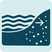
Risk assessment for saline intrusion
Current approaches to analysing saline intrusion provide insight into where risks may occur, but they do not allow for a clear assessment of the damage associated with intrusion. In any case, risk assessments should consider both present conditions and future changes driven by drought and sea level rise. This applies to saline intrusion through groundwater as well as through estuarine systems. An assessment of current conditions provides a useful starting point, as areas affected today are often those most likely to experience increased impacts in the future.
The risk of future saline intrusion is largely influenced by changes in drought and sea level. To factor in the impact of drought on the risk of saline intrusion, please refer to the drought risk assessment. In the risk assessment below, we follow the projections as developed by the Sea Level Rise Knowledge Programme. The table below gives an indication of when a certain sea level rise scenario will be reached for three applied climate scenarios: low, high, and extreme.Saline intrusion via groundwater
| Sea level rise | Under a low emission scenario reached by | Under a high emission scenario reached by | Under an extreme scenario reached by |
|---|---|---|---|
| 0.5 metres | 2050-2150 | 2050-2070 | 2040 |
| 1 metre | 2150-2300 | 2090-2150 | 2060 |
| 3 metres | After 2300 | 2150-after 2300 | 2100 |
Saline intrusion via groundwater
Current situation
To understand the current risk of saline intrusion via groundwater, two steps should be considered. First, identify the locations at which saline intrusion already occurs. This can be done by consulting the Depth of brackish groundwater map in the Climate Impact Atlas. Once known whether saline intrusion already exists at a certain location, the next step is to understand what the current salt load at given location is specifically. This is the volume of salt flowing from the groundwater into the surface water and can be assessed with the Salt load reference map in the Climate Impact Atlas.
Future situations
Once assessed what the current risk of saline intrusion via groundwater is, the next step is to take into account the consequences of sea level rise. Following the projections of the Sea Level Rise Knowledge Programme, it is possible to understand how the current salt load changes with different scenarios of sea level rise: 0.5 metres, 1 metre, and 3 metres. This can be done by assessing the salt load reference map in the Climate Impact Atlas and using the sea level rise options.
Apart from sea level rise, subsidence and autonomous processes can also influence future saline intrusion via groundwater. In locations where subsidence takes place, groundwater levels shift. Such shifting groundwater flows can carry more or less salt, thereby influencing the process of saline intrusion. Autonomous processes refer to regions in which conditions from the past still affect processes in in fresh-saline groundwater. For example, brackish groundwater can continue to flow into deep polders, as a result of the past reclamation. To find out which contribution of factors change the salt load at 0.5, 1, and 3 metres sea level rise, we refer to the Climate Impact Atlas map narrative on saline intrusion. This may be helpful in defining adaptive measures to reduce the risk of saline intrusion.
The extent of saline intrusion is also influenced by the need to flush salt water out of the system, and by the availability of freshwater to do so. In general, flushing demand is expected to increase as sea levels rise: from 0 cubic metres per second (m³/s) at present, to around 50 m³/s with 0.5 metres of sea level rise, 100 m³/s with 1 metre, and up to 350 m³/s with 3 metres. However, these changes are highly location-specific. In some regions flushing demand will increase substantially, while in others it may remain stable. For this reason, the final step is to include the Climate Impact Atlas map 'Change in flushing water demand'. showing projected changes in flushing water demand. Note that future changes in precipitation and evaporation are not included in the map narrative. Changes in precipitation and evaporation directly affect the availability of freshwater in the soil (rainwater lens), with drier conditions increasing the frequency of rainwater lens disappearance.
Saline intrusion via estuaries
Current situation
Understanding saline intrusion via estuaries requires assessing the current conditions. For this, it is advisable to first identify locations at which saline intrusion already occurs for different low river discharges. This can be done by including the river Rhine discharges, which are commonly expressed as the volume of water entering the Netherlands near Lobith. The Climate Impact Atlas map on surface water salinisation via estuaries presents the depth average and tidal average chloride conditions. It indicates by how much surface water will become saline at averagely low discharges. Here, three different scenarios for averagely low river discharges are included: 2000, 1000 and 500 cubic metres per second. This map can be used to assess the current risk of saline intrusion via estuaries.
| Climate type | Average lowest discharge near Lobith |
|---|---|
| Current climate | 2,000 m3 per second |
| Dry summers in a current climate | 1,000 m3 per second |
| Future climate | 500 m3 per second |
Future situations
To assess future risk of saline intrusion via estuaries, consider combining sea level rise scenarios with the same scenarios of low discharges in the river Rhine. This is because, with the rising sea level, saline water is encroaching increasingly further inland. The Climate Impact Atlas map on surface water salinisation via estuaries indicates by how much surface water will become saline at various sea level rises at averagely low discharge volumes. Following this approach, it is possible to assess the risk of saline intrusion via estuaries for 0.5, 1 and 3 metres of sea level rise, each in combination with the three averagely low river discharge scenarios.