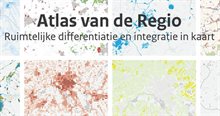
Atlas of the Region
The Atlas of the Region (in Dutch: Atlas van de Regio) is a web-based interactive map viewer with information about spatial development in the Netherlands. It is aimed at regional and local authorities as well as professionals involved in spatial planning, environmental management and policy development across the Netherlands.
What does the atlas offer?
The atlas outlines more than 130 thematic maps that visualise current spatial, demographic and economic trends; future land-use claims; and key topics such as urban expansion, landscape characteristics, water management, protected areas, emissions and noise, climate risk, energy production and agricultural change. Each layer is built on validated, nationally comparable data and can be viewed on its own or overlaid at different scales to spot overlaps, conflicts or integration opportunities. All maps are openly accessible and downloadable.
Who developed the atlas?
The atlas is produced by the Netherlands Environmental Assessment Agency for the Dutch government, with technical support from the Environmental Health Atlas team. This is a first version, which will be refined over time.