KNMI Data Platform
The KNMI Data Platform provides a single access point for meteorological, climate, oceanographic and seismological data gathered by the Royal Netherlands Meteorological Institute (KNMI). It is of use to anyone seeking reliable environmental data: from researchers and public authorities to businesses, app developers and educators.
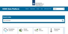
What can you find on the KNMI Data Platform?
With its varied offerings, including datasets, model outputs and developer tools, the KNMI Data Platform is an ideal starting point for exploring weather and climate across the Netherlands. The platform offers:
- Datasets on rainfall, temperature, wind, sunshine & radiation, sea level and seismic events.
- Interactive maps and charts showing current conditions and short-term forecasts, such as radar-based precipitation maps or temperature anomaly charts.
- Historical time series to track long-term trends in climate variables like average temperature, sea-level rise and earthquake activity.
- Data downloads in ready-to-use formats for your analyses, reports or applications.
Who developed the KNMI Data Platform?
The KNMI Data Platform is developed and maintained by the Royal Netherlands Meteorological Institute, under the authority of the Ministry of Infrastructure and Water Management. The platform is continuously enhanced to meet the needs of its diverse user community.